Maps are compelling. By visually connecting the local and the global, they empower us to comprehend large, complex systems with interdependent components and our position within them.
One such system is the electrical grid. Thousands of power plants, millions of miles of transmission lines, hundreds of millions of buildings, and billions of appliances make up one of the most intricate networks humanity has ever created.
Major shifts in building technology, energy generation, and mobility are reshaping our cities. As the built environment evolves, so do our expectations of the grid as one of the systems supporting modern life.
It is becoming clear that future-proofing the grid will require high-fidelity mapping of the interaction between the built environment and the energy system. Geospatial analysis provides the tools required to perform this mapping. Here are 3 examples of geospatial applications supporting 3 areas where physical space and energy connect: sustainable development, distributed energy, and electric mobility.
🏙️ Cities are embracing a carbon-neutral future
As emission reduction targets become more aggressive in cities across the nation, increasing focus is placed on mapping energy flows through buildings and neighborhoods. Just recently San Francisco commited to ensuring all its buildings are net-zero emissions by 2050, while Denver is aiming for 100% renewable electricity community-wide by 2030. Within this context, city officials ask:
- Which buildings consume the most electricity?
- How do we choose the most suitable energy reduction strategy for each building?
- How do we evaluate and plan for neighborhood-scale sustainability measures?
This scale of sustainability planning is complex: different cities exhibit different activity patterns, weather conditions vary, and so do building typologies. A ‘one-size-fits-all’ approach doesn’t translate well across cities, and it is impossible to address a challenge if you can’t measure it.
The growth of geospatial analysis and geocomputation technology, along with the increasing appetite of local goverments and utilities to embrace data sharing, are unlocking new potential.
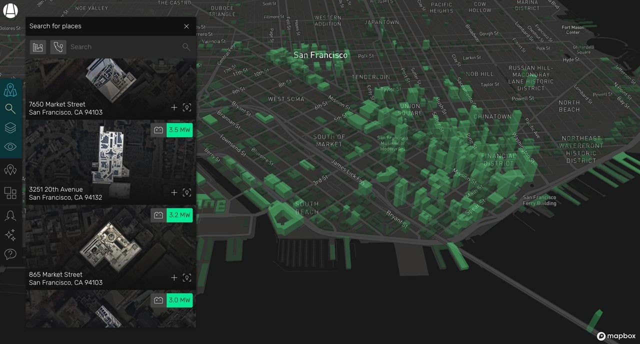 Building-by-building analysis of downtown San Francisco for battery storage potential using Station A (source: Station A)
We now have the software tooling and data to build full building energy models, simulate and evaluate different clean energy deployment scenarios, and track progress towards net-zero energy across city territories. This could help city governments plan better, reach their goals faster, and be more accountable to their constituents.
🗺️ Distributed energy is redrawing the geography of the grid
Historically, energy generation has occured at urban peripheries far removed from cities and densely inhabited areas. Clean, distributed energy is upending that as we speak. Solar panels are installed on urban rooftops, battery storage systems are deployed at residential and commercial buildings, and the geography of the energy system is redrawn.
The fast penetration of clean energy at different locations across the grid is forcing utilities to rethink grid planning as a geospatial problem. Southern California Edison is currently executing on a highly geospatially-targeted distributed energy resource deployment program deploying 256 MW of new capacity at specific substations in its Orange County grid, while a major nuclear power plant is coming offline.
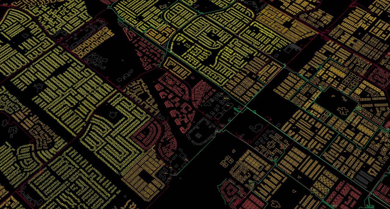 Geospatial analysis of grid capacity for Southern California Edison’s Preferred Resource Pilot (source: Station A)
Location-sensitive deployment and operation of distributed energy resources present a massive opportunity for the environmental and economic resilience of the grid. Virtual power plants, flexible interconnected energy systems, could help lower demand for dirty electricity, provide ancillary services to the grid, and unlock revenue-generating opportunities for building owners.
🔌 Electric autonomous mobility is coming
The mobility landscape is shifting fast. Large car manufacturers such as General Motors and Volvo are pledging to completely phase out the production of gas cars in the near future. The electrification of mobility will require the deployment of new electric car charging infrastructure, a challenge inherently geospatial: charging stations will have to be located according to traffic patterns, census data, and hyper-local grid capacity constraints.
At the same time, autonomous driving technology is entering the market. Fully driverless vehicles are already tested in California’s streets, and early models with auto-pilot features are shipping today.
The increase in autonomous vehicle fleets operated by mobility providers could improve the efficiency of transit while stabilizing the grid. Already equipped with geospatial routing software, these interconnected vehicles could coordinate to park, plug-in and offer their battery storage capacity at constrained grid locations according to researchers from the University of Hong Kong.
Net-zero cities powered by distributed energy and navigated by driverless electric cars would have sounded like science fiction even 10 years ago. As the grid evolves to power life in an evolving world, the ‘where’ is becoming more critical than ever. At Station A, we believe geospatial analysis provides a clear path forward.